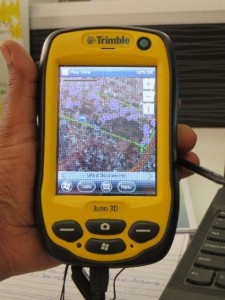
The Central Statistical Agency (CSA) plays a critical role in collecting data. Since 2009, ESSP has worked closely with the GIS department at CSA to create the first Population and Housing Census Atlas using geographic information systems (GIS) software in order to map important population characteristics by woreda.
Now, CSA operates independently to map and publish spatial data. CSA creates atlases using mobile GIS devices and GIS software, as well as organizing and delivering training activities to maintain a sustainable level of expertise within CSA headquarters.
The advantages of using GIS applications in Ethiopia have permeated from CSA to other departments, and consequently the demand for this business-critical tool grows, along with the challenge of retaining staff with the skills to utilize increasingly sophisticated GIS software applications.
ESSP has brought change to the geospatial capacity of CSA, however it also recognizes that learning GIS is an ongoing process and requires regular input to maintain good levels of skill. Read more.
